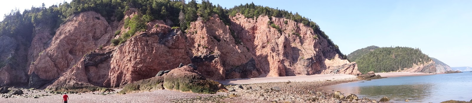
Saturday, August 16, 2014

Reinvigorating the Blog --- Tasmania

Having let my blog lapse, I see two major flaws in with my blogging plan hatched in Summer 2012:   (1) naming it based on my sabbatical, which is long over and now I'm chair and (2) writing too much.  We will all need to get over both.  Since I last posted --- Nova Scotia --- Tom and I have made a few trips to Bend, OR and Laramie, WY, had some good times with family and friends, traveled to Scotland and now I'm spending 6 weeks as a visiting scholar in Tasmania.

So to get us started again, I'm going to start with my adventure to Freycinet National Park, Tasmania. This is  bit of long one.  I can't help it.

 Driving in, the weather was looking perfect and the view from the West/North side of Oyster Bay is pretty awesome.  Headed to those mountains in the distance, but stopping at a few of the vineyards on the way home (the one below was closed, but I stopped at one across the road from this one.

Below, I'm just getting started --- about halfway up Mt. Amos.  Already amazed.

 This may not look like the route up Mt. Amos --- clearly this route includes some "baby" rock climbing and that is the route up --- straight up the rock there.  The standard for this route is 3 hours return.  The visitors center, upon discussion with me, predicted 2 hours return.  I did it in 1:11 and I'm pretty sure I wasn't pushing hard enough and I had to do some route finding up and especially down!  While it was not "nothing, " it was compared to the river bashing off of Mt. Feife in NZ and it seemed considerably easier than Mt. Eliza (but maybe that was because I did it first).  But if you are reading this, thinking about the ascent, make sure you have a dry day like I did!  This is key for this route.  They are not kidding!  I'm pretty sure Mike Steel and Tom Sohayda and others I know could do it in around 45 minutes return. 

Below is a panorama from the top of Mt.
Amos that includes Wineglass Bay/Beach, the "ithsmus" and Hazards Beach.  Later in the day I'm on both beaches and I cross the Isthmus. It was pretty amazing up there. 


Selfie and the hazards signs. I have a weird weakness for these.  I just think they are funny, see the guy slipping.  The best part is that they are NOT KIDDING!  This route should not be done in the wet.  But it was a dry, sunny skies day for me (at least until I was off Mt. Amos).
 The route over the saddle to get from the car park to Wineglass bay.  I saw a family with a boy with a bloody shin --- I say to the mom, "wow that looks like a bummer" and she says, "I think it is broken."  I then stop, throw her big eyes and suggest I help.  She waves me off and says they don't need help.  Really?!  What do you do?  I double checked she said no again and I moved on.  Right thing? (arguable for both of us).
 O.k. biology friends.  WHAT IS THIS?????  My foot is for measure.  It is definitely organic.  Appeared to have gills on the other side (I can send/post other photos).  New to me!
 Above there is a selfie of Wineglass beach from the top of Mt. Amos.  The flat, lumpy looking mountain in the background is Mt. Amos.  So this selfie is of Mt. Amos from Wineglass beach.  Apparently Wineglass Beach is named because they used to catch and gut so many whales in the area that the bay was the color of wine... I went whale spotting, but failed. 
 Biology and Tassie friends.  Round 2 --- What made this?  There were lots of tracks that were obviously  bird.  But this is a Tassie mammal --- I'm sure.  Which one? 

I finally got a photo of a Bennet's Wallaby in the wild.  I see these guys nearly every day here.  Almost like deer at home.  But they are super shy (not like deer at home) and I have been finding it hard to get photos in the wild, but today I did it!  These gums leave a really desolate landscape, loads of room for the wallabies to hang out. 


Left, a water bird.  Anyone know which one?  Right, a view of Wineglass Bay and the hazards from Cape Tourville. 
And the last one on the right is the view to the north of Hazard's beach. 

Thursday, October 17, 2013

Sea Kayaking in Nova Scotia

 We did a sea kayaking trip with Nova Shores around Cape Chignecto in the Bay of Fundy.  This was by far the highlight of our trip and one of those moments where I just can't choose between all the possible photos.  So this is a longer post, but I'll do my best to cull.
 Our first stop came pretty early because the waters seemed quite calm here, but as we adventured out to see if we could do the Cape on Day 1 (waters were predicted to only get more rough) our guide deemed the waters too much for that day --- seem calm here, but as we neared the Cape, much more.

Tent site #1 and a photo of our guide Anthony from South Africa.

One of the best parts of the kayaking trip was "living the Bay of Fundy."  The tide changes are so huge we planned to launch and stop at as close to high tide as we could so we would not have to carry the kayaks 30 vertical feet or more up the beach!
 Breaking down camp on Day 3 (the order of the photos are bit off for a long list of reasons).  We got our only rain on Day 3 ---  you can see Tom's and my tent site in the photo (the dry spot).  We had to move our tent to that spot because Tom, the guide and me all realized, after we first set our tent, that the tide line was dangerously close.  I woke up around 1am with high tide and watched it lap near the edge of our tent --- even in the new sight.  During the photo is is very far away...
 At each site we had a chance to explore the park we were kayaking around.  The next few pictures are Tom and I out for an afternoon run...
 The 3 sisters from the trail we were running.  The next day we were kayaking right up near these rocks. 
 We are exploring a beach at low tide which has very little available space during high tide.  Look on the right side of the photo and you can see the dry sand...
 We did some fun bouldering on the rocks at low tide!

 Running on the beach at low tide.  This is all covered in water at high tide --- past the photo on the left!  It is hard to show.  You need to live it.

 In high tide this is all covered in water.  You can see the tent in the distance.  When we landed, that tent was right were our boats landed on the beach.  See where the water is!
 It is just so pretty in the Bay of Fundy.  These are all pictures from the first night.  Each of these photos are related views of the same thing showing different levels of the water.  One of the most striking is this photo to the right and the center picture below.  They are of the exact same rock, but in the lower one, the water was still well under our feet.  In the one to the right, the spot where we were sitting is on the center left, where there is no water!


 Our guide took some excellent pictures of us in the boat on days 2 and 3, especially as we rounded Cape Chignecto. 
 Here you see the guide taking a picture of the top of our paddles at their peak.  We were in 3-4 foot swells.  For us this was rather exciting!
 Still in the photos as we worked our way around the Cape.


 We were starting to get really good on Day 2 and our guide encouraged us to work our way through some narrower, rougher areas in the rocks.  We are actually passing through and below, just through one of the, but we did several and this was not the most exciting!

 The sisters are behind us --- the sisters were in the running photo above.  We also saw a bald eagle around this time that sat on a rock and watched us as we watched it.  We also saw a number of seals and other birds.

The whole group:  us, the guide and Martha and David on the last day as we finished! We would definitely go back and kayak with Nova Shores again.  Everyone should do this, if they get the chance. 

Travels to Nova Scotia

 In August Tom and I went on an adventure to Nova Scotia.  Why Nova Scotia?  Well, hopefully the blog will speak for itself for how much fun we had.  However, we had a vacation planned, Iceland and Scotland were way more expensive and we realized that we had both always wanted to go to Nova Scotia.  So off we went...

First, thanks to my good friend Sara Faridi for helping with housing in Halifax!  Our first adventure was to explore Halifax and Tom could not stop talking about the fort.  Turns out there is good reason for this.  By far the best fort I have ever been to.  The history is fascinating and you should all go!
 This view is of a small island in the bay that includes fort elements.  Somewhere around there where the big explosion happened.  Destroyed Halifax and killed lots of people because they had all come to witness an event that turned into a very tragic event.
 The fort is in amazing condition and this expresses for me just how much fun this was for Tom!
 The fort gave me some good opportunities to play with my camera settings.  That is Tom exploring the inside of the fort. 
 There is an amazingly large moat that warrants wandering around, trying to climb the walls and exploring entrances. 


 They also do a demonstration with a real explosion of firing the old cannons.  The first one went well, but the second one we witnessed went not so well.  We watched all sorts of folks trying to figure out what went wrong.  We finally had to finally, but the failure was quite entertaining. 
 After the fort we headed out to Peggy's Cove and some exploration of the trails and surrounding terrain.  The rocks are fun and we have some good pictures from there.  The next blog is devoted to the second half of our trip --- the sea kayaking.

 Peggy's Cove was a great place to visit, but these photos hide the fact that there were large numbers of others around us.  Upside --- cool rocks.  Downside --- the entire world is there with you. 

This is the one photo I'll post from our run in the Peggy's Cove area.  The terrain was much like this for the entire run.  Rocks, lakes and vegetation.  It was fun, but more spectacular runs will be posted soon. 

Friday, August 30, 2013

Riding and Racing in Winter Park

 Tom and I went to join Stacee, Jess, Vivian, Matt, and Diane in Winter Park to ride.  Matt and I raced on Saturday while Jess and Stacee volunteered to make everything run smoothly.  Tom and Vivian went joy riding.
 On Sunday we went for a lovely ride in the rain.  O.k. it was wet and cold and we cut it a little short while still doing a rather serious ride.  Photos of the mud...
 Vivian and maps showing to illustrate Tom and Vivian feeling a bit lost on their joy ride...
 Me and the bike getting ready for the big Sunday mud ride.
 Tom is a consummate photographer. 

 We may be muddy, but we had a great time!
 No trip is complete without a dog who loves her belly to be rubbed and
 a dinner stop with Mom and Gerry at Pug Ryan's on the way home. 

Runtopia

We were looking for new and good trail runs in the Bend area and we had driven past a store a few times with the name Runtopia.  I suggested to Tom that we stop into this running store to get suggestions.  When we arrived, we found a new shop under construction whose goal was to support runners, rather than a more traditional running store focused on gear.  They will have (probably already do since I am just that far behind on my blogs) an ice bath and cool full leg compression and ice "socks".  I'm really not doing it justice.  The idea is to bring to the public the recovery resources provided to the most elite runners in the world.  The space is lovely and to make things better they have taps for good bear and kambucha and an entertainment center to keep one occupied while recovering.

Best of all for us the owner was amazingly friendly and sent us on one of our top 10 (top 5??) trail runs of all time, the soda springs/green lakes loop (see the previous post).  Closed to bikes, amazingly beautiful, and entirely runable.  Check them out if you are in Bend, we will next time we are there for sure.