I've picked out a marathon (
Arrowsmith marathon, April 6) to do and so I guess I ought to train. I wanted to do 20+ this past weekend and so Mike suggested the Crater Rim Trail --- the whole thing. This was actually a great idea, but for the spots where I got lost and had to do a bit of trudging through way overgrown trails --- although still nothing as bad as the bad section on my first big trail run in NZ (see the Adventure Runs in New Zealand post). This was great. Awesome views and mostly runnable and all along an obvious crater rim. Just in case anyone is wondering --- Tom will be here soon! Yippeee!
I finally got a new Nike watch and so I have a nice map of this run. The crater has since been filled in by water, but hopefully here you can see the crater rim that I was following. Around Mile 19 I'm in "Taylor's Mistake"--- take that however you want.
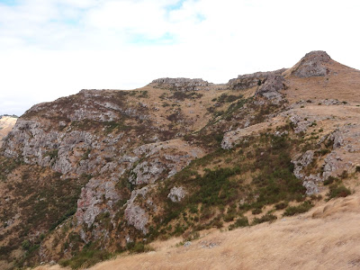
Looking forward. This is not long after I started. I'm headed to the point on the left that is tough to see due to the sun and the clouds.
Looking toward the end of my run, but I'm a lot closer now. Yippeee! I ran out to the "head" you can see on the left. I went pretty much to the very end (had to cut off a small bit to get back to make dinner for friends), then over onto the beach on the left side (can't see that) and into the town of Sumner. Near the end (no pictures, I was tired and in a hurry and around mile 19) I crossed "Taylor's Mistake."
A bit farther along I took a picture looking back toward the start. The bump sticking out in the middle of the picture (the farthest one back of the prominent ones) is about a mile or so from the start of the run and Mike and I climbed up there. That is near where I took the first picture.
 |
| Tripping Hazard |
I ran past a lot of these signs. Mike said I should. It turned out o.k. The tracks are now safe as long as a big earthquake does not hit...and they are clearly doing work on those trails to officially reopen them. These signs preceded each of the pictures below, taken looking back at the trail I had just run. You can see the trail, or it is directly at the bottom of the rock faces you see.
After the slowest part of my trip getting past the rocks in the picture above, I found these WWII batteries. These two pictures are really for Tom and anyone else who is into that sort of thing. :)
And one final gratuitous panoramic photo.


No comments:
Post a Comment